Archive for July, 2012

White man in Idlewild

Wednesday, 18th July 2012; 5:15 pm

20120718-171724.jpg
I’m at the premiere Negro resort of the Midwest. At least it was.

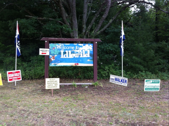
Idlewild is a small community just east of Baldwin. In the days of Jim Crow, this was one of the few places in the country where middle-class African-Americans could come without facing discrimination, and even own property. Not coincidentally, it became a Mecca for jazz and blues musicians. Louis Armstrong and W.E.B. DuBois owned property here. The name itself is so evocative, it sounds like something out of fiction. It was known as “Black Eden”.

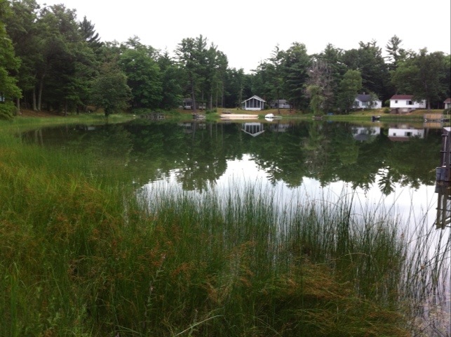
But the silver cloud of desegregation had a grey lining: now that they could go (generally) anywhere, African-Americans no longer needed places like Idlewild, and it has become just another rural village in northern Michigan. Most of the roads were never paved, and the houses were generally small and cheaply made. There’s new construction here too, and a nice little park for public access to crystal-clear Idlewild Lake (where I’m sitting now). There are signs up celebrating the community’s centennial this year.

A little like the dams, I wouldn’t have made this trip just to come here. By coincidence I learned of Idlewild about a month ago, then noticed that it was along the route of this ride. Like the Womyn’s Music Festival or the gay resorts in Saugatuck, it’s not the sort of thing one expects to find around here. But here it is.
20120718-171027.jpg

Croton Hardy Dam

Wednesday, 18th July 2012; 1:39 pm

I got on the road a little after 11, taking advantage of a narrow corridor between rain clouds to get out of town. The roads were wet, which I especially hazardous after the first rain in a long time because it dislodges all the oil and whatnot that’s been accumulating on the road. So I was careful.

I headed pretty much due north on Jupiter Ave and Pine Island Dr, both of which had little traffic. The clouds broke up a but and it’s been partly cloudy so far. I stopped for gas at the freeway exit for Cedar Springs; I really should have filled up before leaving the GR metro area, but I figured (correctly) that fuel would be easyish to find while still in Kent County.

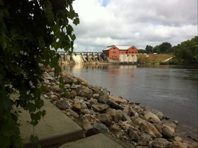
I’ve stopped at Croton Hardy Dam, half because it’s on the way, and Hal because I’ve heard of it repeatedly my whole life and figured I should see it. It’s actually two dams, one after the other, each with its own pond begin it and a hydroelectric plant.

20120718-133829.jpg

I had a lateish lunch at the Driftwood Inn in Croton, nothing fancy, just a quick chicken wrap.

Rainy gauntlet

Wednesday, 18th July 2012; 7:11 am

It’s not raining, and it looks like it won’t rain here today. It’s not raining in Cadillac, and judging from radar it looks like the rain might miss Cadillac too. But it’s raining in between. In fact, there’s a line of heavy rain storms marching in a line between here and there.

At the speed they’re going, it’ll be several hours before they pass, so I don’t think I can just wait them out, not if I want to get there at a reasonable hour. I have still have some preparation to do (such as packing the scooter), so I’ll keep an eye on it and see if I can time my departure to minimize the rain time. Or just gear up and ride through it.

Itinerary 2012

Friday, 13th July 2012; 10:30 pm

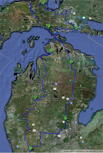
Since I had someone ask about it today (hi, Mom!), here’s the capsule nearest-city version of my itinerary for this year’s Big Ride:

  • Wed, 18th – to Cadillac
  • Thur, 19th – to Petoskey
  • Fri, 20th – to DeTour, UP
  • Sat, 21st – to Tahquamenon Falls, UP
  • Sun, 22nd – to St. Ignace, UP
  • Mon, 23rd – to Atlanta, MI
  • Tues, 24th – to Midland
  • Wed, 25th – to Grand Rapids

And here’s a rough map of the route. Google Maps won’t let me put in all of the detours I plan to make, to stay off major roads, but it should give you a good idea of where I’ll be. The green letters are the places I’ll be camping each night.

Spontaneous planning

Thursday, 12th July 2012; 9:42 am

I’m being a little more pro-active in planning for this trip than I have in the past. For example, I’ve already picked out some restaurants to eat at along the way, and figured out which ferry (10:30am) to take to Mackinac Island. Unless I change my mind.

One reason for the additional planning is that much of this ride is more middle-of-nowhere than previous ones. Riding along the shores of Lakes Michigan (2009) and Huron (2010) meant that there was always another town just ahead, so there was no worry about finding a place for lunch. Riding through well-populated southern Michigan (2011) was similar. But on this trip I’m specifically going through the “left over” parts of northern Lower Michigan, and away from the lakeshore the UP is especially… sparse. For example, the route I’m planning for Sunday starts at a state park about 10 miles past the nearest village, and ends at a national forest 20 miles short of the nearest city, passing through exactly one town (population 1500) along the way. I kinda wanted to make sure I could find a couple meals somewhere on that route, at the times I expect to be hungry. (Thanks to the internet: I can.)

The other reason is that I’m stretching things just a little in terms of how much territory to cover each day. My rule of thumb for a nice scenic ride is 100 miles per day, but six of the eight days on this trip will be 125 or more, and one of the others includes a side trip to Mackinac Island. I want to make sure that I’ll have time to do and see all the things I want to see and do.

There’s some danger of this turning into If It’s Tuesday, This Must Be Belgium, but I don’t think that’ll happen. I’ll still keep my eyes open to other possibilities, and I’m sure I’ll adjust my plans along the way. Then again, if I find myself in Belgium on Tuesday….