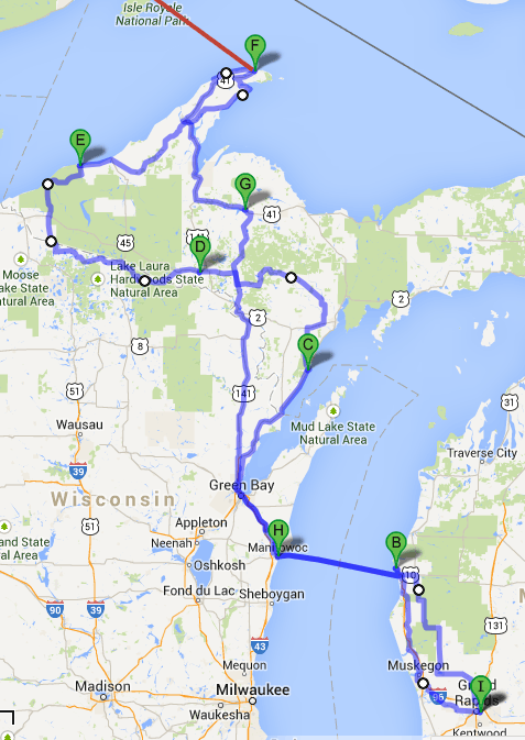
I’ve “finalized” (as much as that’s possible) the route I’ll be taking on my upcoming trip. Here’s a map. The green tags are the places I’ll be stopping each night. Ignore the white dots; those are adjustments to get Google Maps to draw the route where I want to to, rather than where it thinks I should go.
A (hidden): home
B: Ludington
C: J.W. Wells State Park
D: Bewabic State Park
E: Porcupine Mountains State Park
F: Copper Harbor
The red line indicates a side trip to Isle Royale for three days.
G: Michigamme
H: Manitowoc WI
I: home
